


")

The Matsch Valley is an out-and-out paradise for hikers and mountaineers, with something to suit every taste from leisurely farm tours, lakes and Waalweg walks to summit climbs for all abilities and stunning glacier tours.
The following information on time and altitude differences always refer to the actual tour described, not the alternatives, and is to be taken as a guide. For the more challenging tours, a map is always highly recommended.
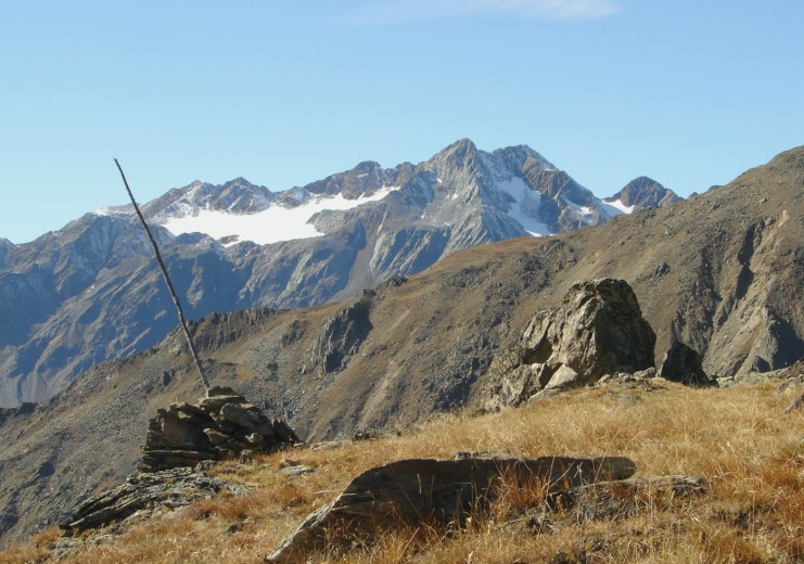
Spitzige Lun (2,324 m)
Die Spitzige Lun (2,324 m) is a year-round hike popular with both locals and guests as it can be walked in practically any weather and is suitable for children. The summit boasts a unique view over the Upper Vinschgau
From the village of Matsch, we walk westwards along trail no. 13, a moderate slope through the forest. After about three quarters of an hour, leave the alpine path to the left and follow trail no. 13 to the Spitzige Lun summit cross. For the Niederjoch (2,474 m) and Hochjoch (2,593 m) alternative, turn off 200 metres before the summit and follow the sweeping ridge into the valley on trail no. 15. We make our way down to the village via Gonda.
Altitude difference: 735 m
Time: 3.5 h
Portlesspitze (3,074 m)
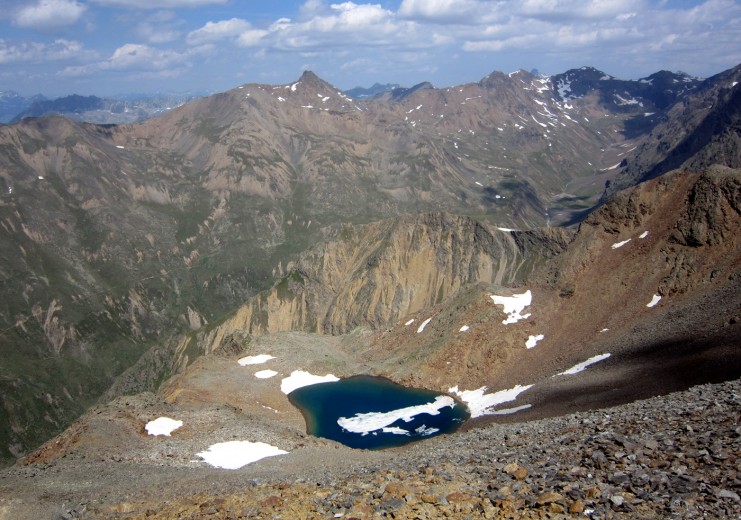
The set-off point for this beautiful tour is the Thaneihöfe or the Glieshöfe farms. We follow trail no. 8 through Eisa, and continue onwards, heading north-west. Signposts alternate with little cairns along the route.
The climb is not demanding on a technical level. A short descent over the steep scree slope northwards to the Portlessee Lake is well-worth the effort.
Altitude difference: 1,250 m
Time: 3.5 h
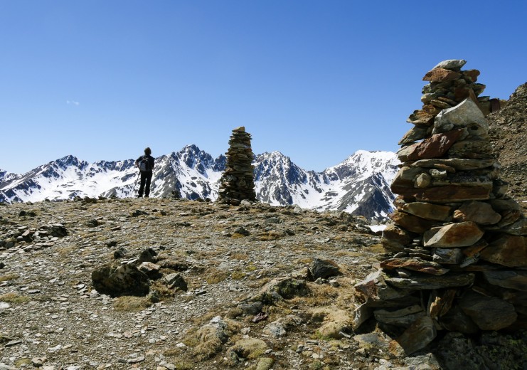
Pleresspitze (3,188 m)
The hike begins on a wide forest path behind the Matscher Alm and leads to the tree line leading to the Muttboden.
At the signpost we follow trail no. 7 for a few metres, after which trail no. 7A leads us past the small Pleressee Lake (2,465 m) uphill to the Pleresboden. During the last stretch we climb over stones and boulders on a mountain plateau and from here, over a ridge to a small saddle.
Heading to the right over rocks, we reach the summit and the newly built Iron Cross with views of the surrounding three-thousand metre peaks including the Valvelspitze, the Rabenkopf and the Weisskugel.
Altitude difference: 1,360 m
Time: 4 h
Litznerspitze (3,206 m) via Run – Remsspitze (3,212 m) – Upital Valley
The set-off point for this tour is the upper Runhöfe on the orographic left side of the valley. From here we follow the forest path into the Remstal up to the Remsböden and the signposted route to the Litzner Schartl saddle (3,142 m).
Here both the Litznerspitze peak on the right and the Remsspitze on the left can be climbed. Surefootedness is a must from here onwards. Descent from Remsspitze along the well-signposted trail to Upialm alpine pasture and hut and on to Glieshof.
Altitude difference: 1,500 m
Time: 4.5 hours to Remsspitze
(Through the Upital Valley back to Glieshof: plus 2.5 h)
Oberettes mountain hut – Höllerscharte saddle (3,280 m)
The Höllerscharte saddle was the former route to the Weisskugel and was named for Franz Höller, a merchant from Karlsbad, who earned himself the honour through the building of the hut. In gratitude, the hut was called the “Höllerhütte” for about 20 years.
From the hut we climb the path no. 5 up into the valley below the Oberettescharte saddle. We turn left here, and take a small, secured steep escarpment to Höllerscharte saddle, where a magnificent view of the Weisskugel opens out.
Alternatively, the outer Quellspitze (3,385 m) can be climbed to the summit (keep to the right of the saddle) or follow the signposted ridge out of the valley to the Spaiktsee Lake and, from there, take trail no. 5b back to the hut.
Altitude difference: 600 m
Time: 4.5 hours for the entire loop route
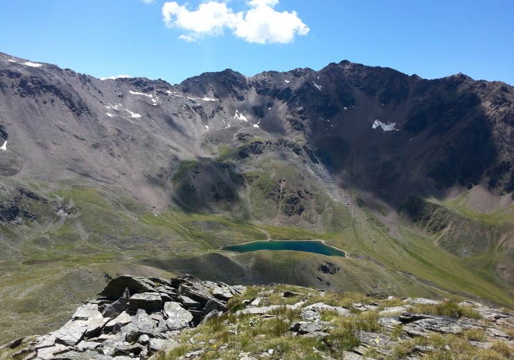
The classic: The Saldurseen Lakes
The classic of the high-altitude hikes of the Matsch Valley is the Lakes Tour “iber die Lockn,” as it known to the locals. The former mountain-hut landlord Roman Burgo writes of this hike: „Five high mountain lakes of rare beauty adorn magnificent mountain scenery: In their crystal clear waters are reflected the glowing, steep glaciers of Lazaun and Saldur, the blue sky over Matsch and the rusty-red, age-old glaciers of the southern Ötztal. The plateau has an almost Tibetan air …“
The hike begins at the Glieshof and requires some stamina. The tour can either pass the Oberettes Cottage (for families, for example, with overnight accommodation) to the Saldurseen Lakes and the Glieshof or vice versa. From the hut we climb a steep ascent up to 3,000 metres and then over the terraces of the plateau to the individual lakes, each of which glows in a different shade. After the last lake, the path leads down in a steep descent to the Inner Matscher Alm.
The hike calls for sure-footedness and good weather. The best time is July to October. If you wish, you can extend the hike with a trip to the summit of the isolated Spitzat or the Schwemmserspitze to the south.
Altitude difference: 1,200 m
Time: 6.5 h for the entire loop route