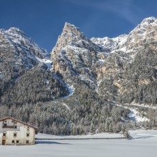
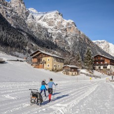
The Gschnitztal is a western lateral valley of the Wipptal and is situated in the Stubai Alps, at the foot of several peaks like the Habicht (3,277 m), the Feuersteine (3,267 m) and the Tribulaune (3,097 m). The valley is characterised by the simultaneous occurrence of limestone, crystalline, primary rock and dolomite, which forms the basis for an unusually large botanical diversity. The valley Gschnitztal is flanked in the east by gentle mountains, moving towards west they become higher and higher, uniting many three-thousand meter peaks at the end of the valley.
The villages are situated in a sunny location between 1,214 m and 1,242 m above sea level. The Gschnitzbach stream flows from its source at the Lauterersee through the flat U-shaped valley, which was shaped by the Ice Age, to its mouth in the Sill near Steinach and covers a distance of approx. 20 km. A predominant part of the villages consists of the landscape conservation areas of Serles-Habicht-Zuckerhütl (total area 180 km²) and Nösslachjoch-Tribulaune (total area 92 km²), in which Natura 2000 areas and landscape parts that are particularly worthy of protection are also designated.
General information
Height above sea level of the highest settlement: 1,242 m (Gschnitz)
Highest point: Habicht (3,277 m)
Resident population in the valley: 1,735 (Trins 1,280, Gschnitz 455)
Villages
- Trins
- Gschnitz
Mountain range
- Stubai Alps
Main peaks
- Blaser (2,241 m)
- Gargglerin (2,470 m)
- Glättespitze (3,133 m)
- Goldkappl (2,788 m)
- Gschnitzer Tribulaun (2,946 m)
- Habicht (3,277 m)
- Hammerspitze (2,634 m)
- Innere Wetterspitze (3,053 m)
- Ilmspitze (2,692 m)
- Kalkwand (2,564 m)
- Kesselspitze (2,728 m)
- Kirchdachspitze (2,840 m)
- Leitner Berg (2,309 m)
- Muttenkopf (2,638 m)
- Östl. Feuerstein (3,268 m)
- Pflerscher Tribulaun (3,096 m)
- Rötenspitze (2,481 m)
- Schneespitze (3,147 m)
- Weißwandspitze (3,016 m)
- Wetterspitze (3,053 m)


