


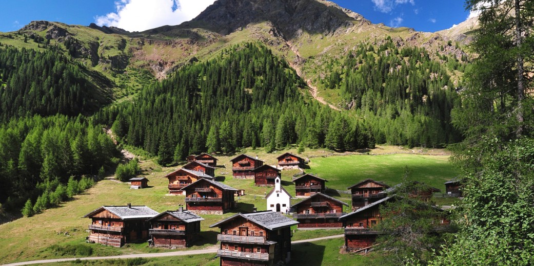


The Villgratental valley near Sillian, together with the municipalities of Ausservillgraten (1,287m) and Innervillgraten (1,402m), is still an Alpine high valley associated with upland farming. The side valley of the East Tirolean Pustertal valley, with many steep, still manually-farmed slopes and traditional timber architecture, is one of the most pristine natural and cultural landscapes in the Alps.
Villgratental valley has made a name for itself in recent decades, not just as a snow-assured ski touring area with its high density of rewarding ascents and descents, but also on account of the recently-opened circular route known as “Herz Ass” and also the Osttirol 360° long-distance hiking trail. Both have enhanced the reputation of the area as a top Alpine destination.
General information
Height above sea level of the highest settlement: 1,639m (Kalkstein)
Highest point: 2,962m (Weisse Spitze)
Resident population in the municipality: 830 in Ausservillgraten, 1,010 in Innervillgraten
Villages & Hamlets
- Innervillgraten (1,402m)
Hamlet - Kalkstein
- Außervillgraten (1,287m)
Hamlets: - Dorf
- Unterfelden
- Unterwalden
- Versellerberg
- Winkeltal
Mountain ranges
- Defreggengebirge
- Villgrater Berge
- Südtiroler Dolomiten
Main peaks
- Weiße Spitze (2,962m)
- Rote Spitze (2,956m)
- Hochgrabe (2,951m)
- Degenhorn (2,946m)
- Regenstein (2,891m)
- Gölbner (2,943m)
- Gumriaul (2,918m)
- Rappler (2,812m)
- Hochalmspitze (2,797m)
- Kugelspitze (2,796m)
- Riepenspitze (2,776m)
- Rotes Kinkele (2,763m)
- Gabesitten (2,665m)
- Toblacher Pfannhorn ( 2,633m)
- Kreuzspitze (2.624 m)
- Marchkinkele (2.545 m)
- Thurntaler Spitze (2.407 m)