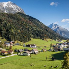
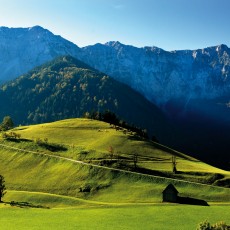
The municipality of Zell-Sele is located on the border with Slovenia in a secluded high valley between the main and northern chain of the Karawanks Mountains. Apart from the small village of Zell, there are numerous farmsteads scattered around in picturesque clearings at an altitude of between 850m and 1,140m above sea level.
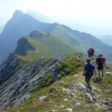
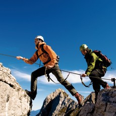
Mountain enthusiasts love the numerous, demanding tours on the Koschuta Massif that towers above Zell-Sele. Particularly recommended are the new via ferratas on the Lärchenturm and Koschutnikturm mountains. Leisure hikers will enjoy the newly-established Freibach hiking trail and the Hainschgraben water adventure trail. For multi-day hikes check out the Alpine Convention Trail – Around the Koschuta.
General information
Height above sea level of Zell-Pfarre: 950m
Highest point: 2,139m (Hochobir)
Resident population in the municipality: 608
Hamlets
- Zell-Pfarre
in Slovenian:
Sele-Cerkev - Zell-Freibach
Sele-Borovnica - Zell-Schaida
Sele-Šajda - Zell-Mitterwinkel
Sele-Srednji Kot - Zell-Oberwinkel
Sele-Zvrhnji Kot - Zell-Homölisch
Sele–Homeliše - Zell–Koschuta
Sele-Košuta
Mountain range
- Karawanken
Main peaks
- Ferlacher Horn
in Slovenian:
Grlovec (1,840m) - Loibler Baba
Košutica (1,968m) - Koschutnikturm
Košutnikov turn (2,136m) - Hochturm
Veliki vrh (2,066m) - Hajnžturm
Kladivo (2,093m) - Dicke Koschuta
Tolsta Košuta (2,059m) - Breitwand (2,124m)
Vzhodnji vrh Macesje - Freiberg
Setiče (1,923m) - Hochobir
Obir (2,139m)
